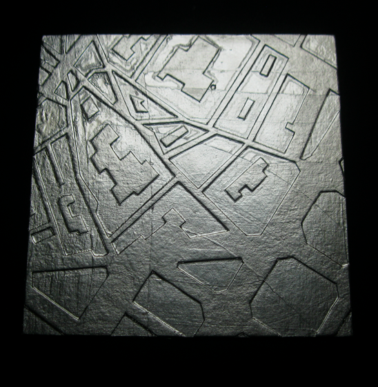
An experimental cardboard intaglio plate.
The image is taken from maps of Idelfons Cerdà's 1853 plan for the city. But not all of Cerdà's plan was built. This image corresponds more to an imaginary city than the real city.
This spot is where the Raval and the grid knit together. It's near the Sant Antoni stop on the purple line.
Final print measure 11x15"
The printmaking process:
1) Clamp together a thick piece of bookboard and to a thinner one. Sand the edges of both together, like you would do to make a two color intaglio print. Bevel them to a 45 degree angle.
2) Cut your relief out of the thinner piece of board. Reverse your image. Any dents in the cardboard will print. I bought a heavy duty box cutter for this. I suppose you could also have somebody laser cut this for you, but you're making a cheap intaglio plate, remember?
3) Glue together with PVA. Put under weight overnight.
4) Decide whether to print with wet or dry paper? Wet paper is damp packed the night before. This is a good option for heavy paper (300+ gsm). If printing wet, coat your plate with aluminum foil or matte medium so the paper doesn't stick. With foil, turn in the edges as you would when making a case for a book.
If you're using a thinner paper (150ish gsm), just put a sheet of tissue paper between your plate and the paper. You can get enough impression without soaking.
5) Crank the plate through the press with two blankets, a foam pad (to keep the blankets in good shape), and a lot of pressure. If you printed with damp paper, dry prints with a weight between sheets of blotter until no longer humid. The blotter may have to be cut to frame the image, in order not to flatten the relief.


This is just delightful! The print is wonderful. Well done!
ReplyDelete